246
246
Dec 2, 2012
12/12
by
KRON
tv
eye 246
favorite 0
quote 0
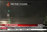
the napa river, at st. helena is expected to crest around noon. with two- feet over its flood stage. the flood stage is at 16 ft.. and if it goes towards map but it could reach its flood stage later this afternoon. >> the russian river? >> the russian river, near well above its flood stage. later this afternoon. as it works down towards guernville. just under 32 ft. and cresting overnight tonight and tomorrow. >> as you move the south and south-east in the santa cruz mountains they have also been concerned as well as rivers and streams. how is that? >> there have been good responses with 2-3 in. of rain fall of the higher elevations. officials are watching that area. the creeks are responding, everywhere. good advice and keeping people away from the water waste. not a good time to be out. be careful with driving through a flooded road race. it is a good way to get into trouble very fast. >> rob, if you're looking later what would you tell people that live along the napa ri in the nab russian river? >> the flow is going to continue to remain high i
the napa river, at st. helena is expected to crest around noon. with two- feet over its flood stage. the flood stage is at 16 ft.. and if it goes towards map but it could reach its flood stage later this afternoon. >> the russian river? >> the russian river, near well above its flood stage. later this afternoon. as it works down towards guernville. just under 32 ft. and cresting overnight tonight and tomorrow. >> as you move the south and south-east in the santa cruz mountains...
338
338
tv
eye 338
favorite 0
quote 0
so 36 for napa. livermore valley yeah, upper 30s as well. 40s elsewhere, with one of the warmest lock indication, san francisco. forecasting 47-degrees there. high pressure, a dirty ridge, we know it is because it's allow something of these clouds to sink in across the bay area. but it is definitely kicking the storm track well to the north, and as this high builds over the bay area, the next couple of days, the storm track will move further to the north, which means that's where the rain is going to be, to the north. we may see a few high clouds, but the high is also going to generate the mild offshore winds so look for warmer days ahead, especially sunday and monday. by tuesday this thing starts to break down and that's what is going to allow the storm door to open back up with cloud, cooler temperatures and a chance of showers moving in on wednesday. enjoy the day tomorrow. warmer temps. santa -- antioch, 6 3. patches of densing for in the delta. 63 for monterey. a couple of dry days. mild tempera
so 36 for napa. livermore valley yeah, upper 30s as well. 40s elsewhere, with one of the warmest lock indication, san francisco. forecasting 47-degrees there. high pressure, a dirty ridge, we know it is because it's allow something of these clouds to sink in across the bay area. but it is definitely kicking the storm track well to the north, and as this high builds over the bay area, the next couple of days, the storm track will move further to the north, which means that's where the rain is...
350
350
Dec 9, 2012
12/12
by
KRON
tv
eye 350
favorite 0
quote 0
temperatures 40's and napa, novado, '50s in san francisco. mid 40's for the east bayshore. a mixture of 50s and 60s indicated by the green. more widespread by noon. and as for the afternoon highs upper 60s. for those going out this evening a mixture of 50s and 60s. taking a look at those numbers. half moon bay, 60s and oakland. sunny for los gatos with mid-60s for the inland valleys. 69 degrees and the santa rosa. and even beautiful conditions expected for downtown san francisco. though snowfall expected for lake tahoe. we are showing some what weather in the forecast. >> on that note, thank you, john do. if the crowds and traffic... janu. >> if the crowds and traffic shopping. you're in luck. today, we have some gift ideas you can purchase online or at least look into ahead of time before venturing outside. joining us this morning is. mike wallenfels. he's the c- e-o of timbuk 2 in san francisco. >> for the adrenaline junkie dad - gopro hero3 silver edition: $299 it has better resolution, and easy to use and it is even a wireless capability. >> the size of this is amazing.
temperatures 40's and napa, novado, '50s in san francisco. mid 40's for the east bayshore. a mixture of 50s and 60s indicated by the green. more widespread by noon. and as for the afternoon highs upper 60s. for those going out this evening a mixture of 50s and 60s. taking a look at those numbers. half moon bay, 60s and oakland. sunny for los gatos with mid-60s for the inland valleys. 69 degrees and the santa rosa. and even beautiful conditions expected for downtown san francisco. though...
327
327
tv
eye 327
favorite 0
quote 0
novato, nine miles, napa, the fog migrating towards the east, napa, seven miles visibility. the rest of the bay area doing pretty good but the central valley fog will migrate back torts the west overnight. that could pose some travel problems tomorrow morning. right now we're 54 in antioch. 44 in concord. 52, san francisco. napa, 40. 48 in mountain view. we'll continue with the patchy areas of dense fog overnight. warmer getting into sunday and monday, and then start to cool things down and bring showers back into our forecast. lows tonight, generally mid-to upper 30s in the north bay, a little warmer thanks to the veil of clouds over you. 47 for san francisco tonight and we'll go 37 with pockets of fog near the livermore valley area. here's what i'm talking about. fog, very dense in the central valley, and then the winds migrate back towards the west so towards the delta, antioch, oakley, brentwood, you may wake up with very dense fog and then it should start to thin out by around, i'd say,here's the 11:0. here's the setup. high pressure diverting storms to the north of us.
novato, nine miles, napa, the fog migrating towards the east, napa, seven miles visibility. the rest of the bay area doing pretty good but the central valley fog will migrate back torts the west overnight. that could pose some travel problems tomorrow morning. right now we're 54 in antioch. 44 in concord. 52, san francisco. napa, 40. 48 in mountain view. we'll continue with the patchy areas of dense fog overnight. warmer getting into sunday and monday, and then start to cool things down and...
181
181
tv
eye 181
favorite 0
quote 0
novato, nine miles, napa, the fog migrating towards the east, napa, seven miles visibility. the rest of the bay area doing pretty good but the central valley fog will migrate back torts the west overnight. that could pose some travel problems tomorrow morning. right now we're 54 in antioch. 44 in concord. 52, san francisco. napa, 40. 48 in mountain view. we'll continue with the patchy areas of dense fog overnight. warmer getting into sunday and monday, and then start to cool things down and bring showers back into our forecast. lows tonight, generally mid-to upper 30s in the north bay, a little warmer thanks to the veil of clouds over you. 47 for san francisco tonight and we'll go 37 with pockets of fog near the livermore valley area. here's what i'm talking about. fog, very dense in the central valley, and then the winds migrate back towards the west so towards the delta, antioch, oakley, brentwood, you may wake up with very dense fog and then it should start to thin out by around, i'd say, 10:00, 11:00. here's the setup. high pressure diverting storms to the north of us. t
novato, nine miles, napa, the fog migrating towards the east, napa, seven miles visibility. the rest of the bay area doing pretty good but the central valley fog will migrate back torts the west overnight. that could pose some travel problems tomorrow morning. right now we're 54 in antioch. 44 in concord. 52, san francisco. napa, 40. 48 in mountain view. we'll continue with the patchy areas of dense fog overnight. warmer getting into sunday and monday, and then start to cool things down and...
391
391
Dec 2, 2012
12/12
by
FOXNEWSW
tv
eye 391
favorite 0
quote 1
napa valley, city of napa was expecting a crest of at least two feet to rise above the flood stage. back in 2005 the city of neep was hit very badly by floods. this time they are saying they can protect the city. take a listen. >>> because of the history of flooding in napa we have a good idea where the water will come out first. there are certain points and we can plan in advance. if this moment if the projections are accurate we'll probably looking at street flooding, intersections being flooded, nothing terribly serious. >> reporter: and caveat may be necessary. there are flash flood warning around the bay area. two flash points they are looking at truck key river in nevada because of low snow levels -- truckee river and the russian river in guerneville, flooding on potentially big scale. guerneville, it's going fake up to two days to leach the coast. two days ahead of us. pg&e the utility is saying 54,000 customers without power and there was one power pole in san francisco that got smacked in two by the force of gail winds. with the weather now and all the rain has dissipated i
napa valley, city of napa was expecting a crest of at least two feet to rise above the flood stage. back in 2005 the city of neep was hit very badly by floods. this time they are saying they can protect the city. take a listen. >>> because of the history of flooding in napa we have a good idea where the water will come out first. there are certain points and we can plan in advance. if this moment if the projections are accurate we'll probably looking at street flooding, intersections...
 Live Music Archive
 Librivox Free Audio
 Metropolitan Museum
 Cleveland Museum of Art
 Internet Arcade
 Console Living Room
 Books to Borrow
 Open Library
 TV News
 Understanding 9/11